Weather Radar Widget
As the summer storm season continues, I wanted a quick way to see the local weather radar and get an idea of what might be coming. I have used GeekTool in the past to put images/webpage data onto the desktop, but I was having trouble embedding the radar image from Environment Canada.
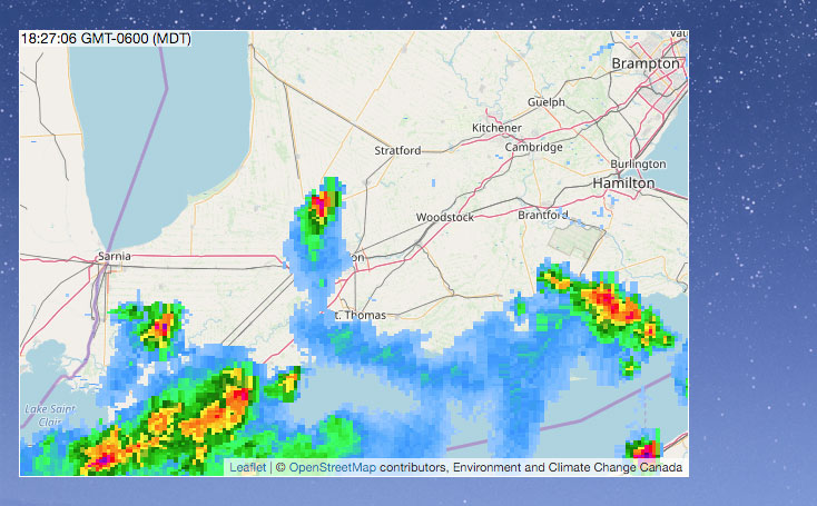
GeekTool doesn’t let you crop the webpage being embedded, and I cannot link directly to the radar image as it is actually a composite of multiple image layers. I would need to host a webpage that has a customized version of the radar, and an alternate way to get that radar data.
Fortunately, Metereological Services Canada (MSC) has a Web Map Service (WMS) for providing Radar images (among other things). WMS is quite interoperable and well-supported, and I was able to make a quick preview with Leaflet and WMS tile layers.
I also found Übersicht, another desktop widget tool that uses JavaScript directly to code widgets. Combining Übersicht with a Leaflet map showing WMS radar data, I had a desktop widget that automatically refreshes every 10 minutes with new radar images.
Get the Widget (MacOS)
The widget is freely available on GitHub, with some additional screenshots showing some other map styles.
It defaults to showing the layer for rain precipitation rates, but snow precipitation is also available.
Other Countries/Regions
I only added support for Canada, as I am not sure what other WMS sources are available around the world. The Canada GeoMET WMS includes coverage for the United States as well, although US users may get better WMS performance by using a US-hosted WMS instead.
If you fork the repo and add support for other regions, let me know and I can link to you.